US
US
$3,125
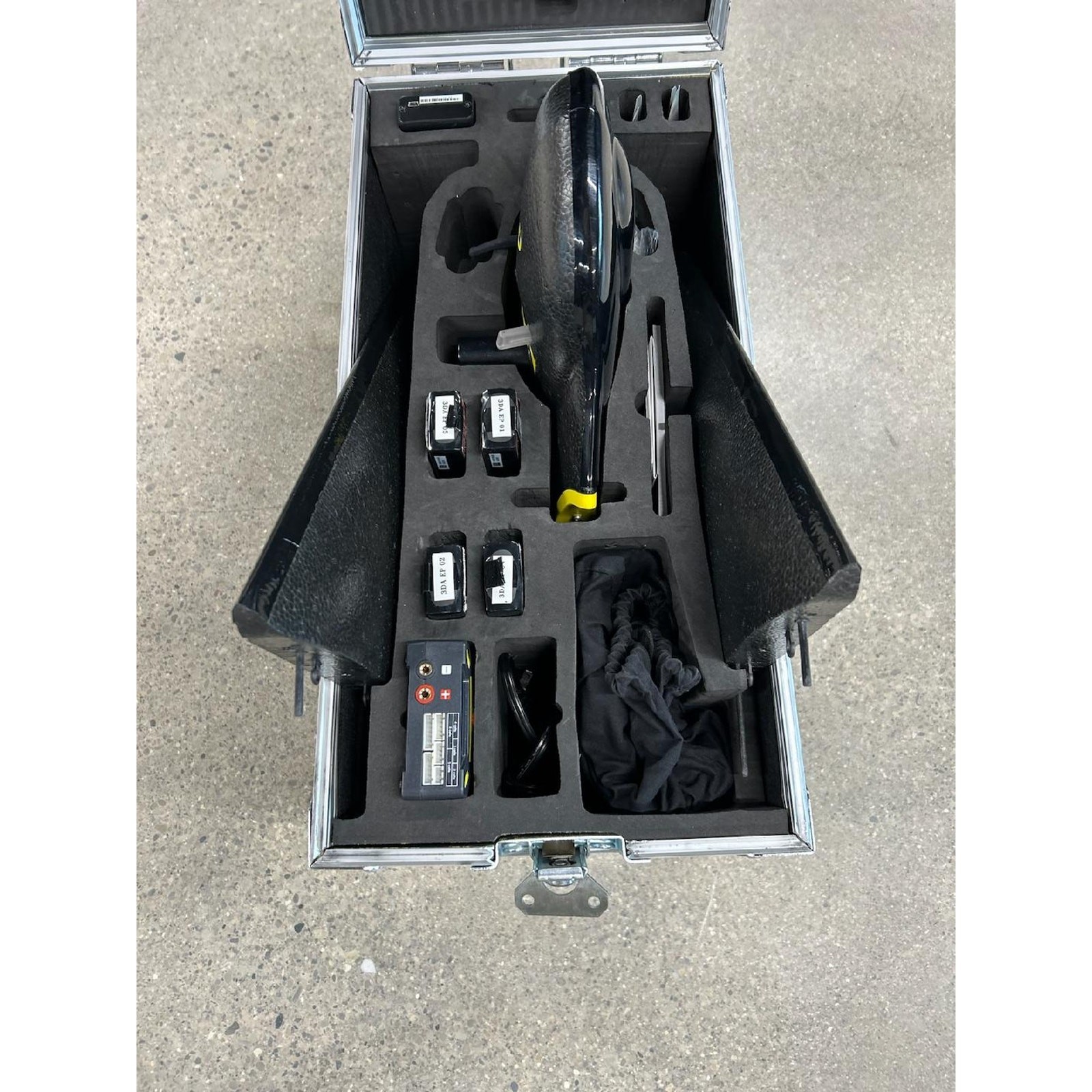
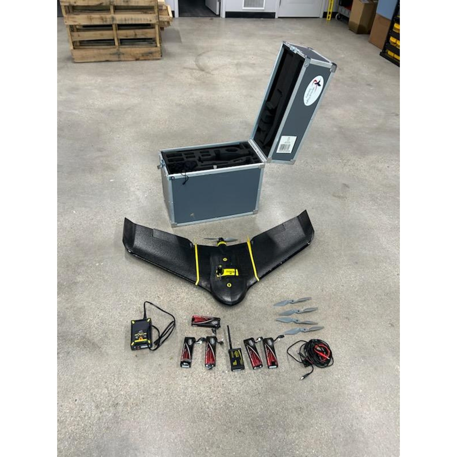
The senseFly eBee Real-Time Kinematic (RTK) is a fully autonomous and survey-grade mapping drone. The eBee RTK enables highly precise, centimeter-level accuracy for aerial mapping without relying heavily on ground control points (GCPs). This fixed-wing drone integrates with base stations and software like eMotion for a streamlined workflow, reducing field time by allowing accurate photogrammetry in real-time, ideal for surveyors and engineers needing quick, reliable data for orthomosaics and 3D models.
Efficient- The eBee RTK can cover up to 12 km2 (4.6 mi2) in a single automated mapping flight. Flights over smaller areas, at lower altitudes, can acquire images with a ground sampling distance of down to 0.6 in per pixel.
Easy - The eBee RTK is the easiest to use mapping drone on the market—just throw it into the air. It then flies, captures images and lands itself. No piloting skills required!
Safe - The eBee weighs just 700 g (1.5 lb), vastly minimizing its kinetic energy.